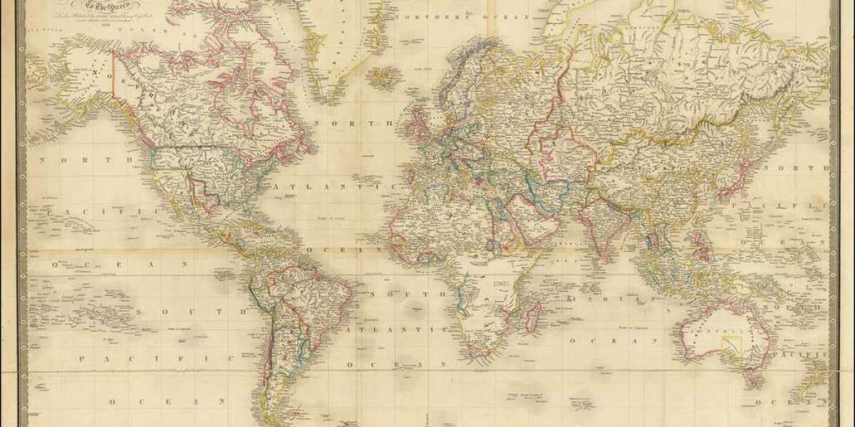
Maps are more than just guides to physical landscapes—they are windows into the minds of those who dared to imagine the world before it was fully known. Vintage cartography, the study and collection of old maps, carries with it not only historical significance but also a deep aesthetic and cultural appeal. These maps are time capsules, preserving the scientific knowledge, artistic trends, and worldviews of different civilizations. They reveal how people perceived continents, oceans, and even mythical lands centuries ago. As the world becomes increasingly digitized, the beauty and mystery of vintage maps continue to captivate historians, collectors, artists, and explorers of the mind alike.
The Evolution of Cartography Through the Ages
Cartography began as an attempt to make sense of our surroundings. Early maps from Mesopotamia and ancient Greece were often symbolic, mixing geographical accuracy with religious or philosophical ideas. As empires expanded and global exploration intensified during the Age of Discovery, cartography evolved rapidly. Explorers like Marco Polo and Christopher Columbus brought back knowledge that reshaped European maps, introducing previously unknown lands and altering borders.
By the 16th and 17th centuries, the printing press enabled the mass production of maps, democratizing access to geographic knowledge. The rise of maritime empires such as Portugal, Spain, and the Netherlands gave birth to highly detailed nautical charts and atlases that were both functional and visually stunning. Mapmakers, or cartographers, became both scientists and artists, employing engravers and illustrators to create maps that were as decorative as they were informative.
Symbolism and Imagination in Antique Maps
One of the most intriguing aspects of vintage cartography is its use of symbolism. Early maps were often filled with illustrations of sea monsters, gods, and imaginary lands. These elements served both as warnings and as imaginative placeholders for uncharted territory. The phrase “Here be dragons,” though rarely used literally, encapsulates this blend of wonder and fear.
Maps also reflected the political and religious ideologies of their time. For instance, Jerusalem was often placed at the center of medieval Christian maps, symbolizing its spiritual importance. Imperial maps, on the other hand, emphasized the might of the nation by exaggerating the size or prominence of its territories. These choices reveal much about the cultural biases and ambitions of the societies that produced them.
The Aesthetic Beauty of Handcrafted Maps
Before digital precision, maps were handcrafted using delicate lines, intricate shading, and artistic flourishes. The tools of the trade—compasses, dividers, pens, and engraving plates—were wielded by skilled artisans who worked closely with geographers. The resulting works were masterpieces of design, often incorporating elements of calligraphy, illustration, and ornamental borders.
Color was another important aspect. Since printing in color was a labor-intensive process, many maps were hand-colored after printing. This added a layer of uniqueness to each piece. The subtle hues of blues, greens, and golds created rich visual textures that modern reproductions often fail to replicate. Today, these features are what make antique maps so desirable to collectors and interior designers alike.
Mapping Myths and Legends
Many vintage maps were not just records of geographical reality but also repositories of myths and legends. The fabled island of Hy-Brasil, supposedly located west of Ireland, appeared on maps for centuries despite never being found. Similarly, the Northwest Passage—a sea route connecting the Atlantic and Pacific Oceans—haunted cartographers and explorers, shaping maps long before its actual discovery.
These mythical elements underscore the adventurous spirit of cartography. Maps did not merely chart the known; they invited the viewer to imagine the unknown. The inclusion of lost continents, such as Atlantis, or speculative geography based on travelers’ tales, gave maps a narrative quality. They were not just scientific tools but storytelling devices, capturing the collective imagination of the times.
The Role of Cartographers: More Than Mapmakers
Cartographers of the past were scholars, adventurers, and artists rolled into one. Figures like Gerardus Mercator, Abraham Ortelius, and Martin Waldseemüller weren’t merely plotting coastlines; they were revolutionizing the way people understood the world. Mercator’s famous projection, for instance, allowed sailors to navigate with greater accuracy, despite its distortion of land masses.
These individuals often worked under royal patronage or for wealthy merchants, and their work had strategic importance in trade, colonization, and warfare. Some maps were even kept secret, their knowledge too valuable to be shared openly. In this way, vintage cartography was also a form of intellectual and geopolitical power, mapping not just terrain, but dominance.
Collecting Antique Maps: A Journey Through Time
Collecting vintage maps has become a passion for historians, bibliophiles, and art lovers. Each map tells a story, not just of the land it depicts but of the culture and moment in which it was created. Some collectors specialize in maps of specific regions or themes—such as celestial charts, war maps, or colonial territories—while others are drawn to particular mapmakers or artistic styles.
The value of antique maps can vary significantly, depending on factors like age, rarity, condition, and historical significance. A first edition of Mercator’s atlas or a hand-colored map of the New World from the 16th century could fetch thousands—or even hundreds of thousands—of dollars. But beyond monetary worth, many collectors find emotional and intellectual satisfaction in piecing together the cartographic puzzle of human history.
The Digital Renaissance of Vintage Cartography
In today’s digital age, vintage cartography is enjoying a renaissance. High-resolution scans of antique maps are now available through online archives, universities, and museums. This accessibility has opened the world of historical cartography to a global audience. People can explore the past geography of their hometowns or trace the shifting borders of empires from the comfort of their homes.
Digital technology has also allowed artists and designers to repurpose vintage maps for contemporary use. Whether it’s wall art, clothing, or stationery, the aesthetic of old maps continues to inspire. Moreover, GIS (Geographic Information Systems) technology now overlays historical maps with current data, providing fascinating insights into urban development, environmental changes, and migration patterns.
The Enduring Allure of the Map
So why does vintage cartography continue to hold such power over us? Perhaps it's because maps speak to a universal desire: to understand our place in the world. A map is both a scientific document and a work of art, a factual record and a leap of imagination. It blends logic with creativity, offering both guidance and mystery.
In a time when GPS apps and satellite images have made the world seem smaller and more accessible, vintage maps remind us of a period when the earth was still full of secrets. They challenge us to think about how far we’ve come and how much remains unknown. They are relics of exploration, expressions of human curiosity etched in ink and paper.
Conclusion: A Mapmaker’s Legacy
Vintage cartography is more than the study of old maps—it’s a journey into the collective memory of humankind. From the earliest scratched diagrams to the grand atlases of the Enlightenment, maps have shaped the way we see the world and our place within it. They are testaments to discovery, creativity, and the eternal quest for knowledge.
In cherishing these antique documents, we don’t just preserve history—we connect with it. Each fold, each faded ink line, and each whimsical sea creature tells a story of someone reaching into the unknown, trying to make sense of the vast world around them. And in that pursuit, we find the timeless spirit of humanity itself, etched across parchment seas and forgotten frontiers.