
Famous Voyages Preserved in Historic Nautical Charts

Historic nautical charts are more than drawings of coastlines and oceans. They are lasting records of exploration, navigation, trade, discovery, and human curiosity. Long before modern satellite navigation and digital mapping systems, sailors depended on carefully prepared charts to understand unfamiliar waters, identify coastlines, locate islands, and plan difficult journeys. Many famous voyages became closely connected with the charts created before, during, and after these expeditions.
From the voyages of Christopher Columbus across the Atlantic to the Pacific expeditions of James Cook, historic nautical charts preserve evidence of how people gradually expanded their understanding of the world. These documents reveal not only where explorers traveled but also how geographical knowledge changed from one generation to another. Coastlines that were once marked with uncertainty gradually became more accurate, while previously unknown islands and waterways were added to European maps.
Today, historic nautical charts provide researchers, historians, collectors, and maritime enthusiasts with an opportunity to explore the past through geography. Every line, annotation, compass rose, and sailing route can tell part of a much larger story.
The Importance of Nautical Charts in Exploration
During the age of exploration, a reliable chart could be one of the most valuable possessions aboard a ship. Ocean voyages involved enormous distances, unpredictable weather, unfamiliar coastlines, and limited navigational technology. Sailors needed charts to estimate their position and understand the waters ahead.
Early nautical charts often contained information gathered from previous voyages. A captain might use an existing chart while adding new observations based on personal experience. Soundings, coastal features, islands, reefs, currents, and harbours could gradually be incorporated into later editions.
This process meant that nautical charts developed alongside exploration itself. Each major voyage had the potential to improve geographical knowledge. The chart became both a practical navigation tool and a historical record of discovery.
Christopher Columbus and the Atlantic Voyages
The voyages of Christopher Columbus are among the most famous journeys associated with the early European exploration of the Atlantic. Beginning in 1492, Columbus crossed the Atlantic while searching for a western route to Asia. His expedition reached islands in the Caribbean, opening a new chapter in European exploration of the Americas.
Charts associated with the period help illustrate how limited European geographical knowledge was at the beginning of these voyages. The Atlantic Ocean was already represented on maps, but many regions were based on incomplete information, assumptions, and reports from earlier travelers.
After Columbus's journeys, European cartographers began incorporating new coastlines and islands into their work. The resulting maps were often inconsistent, but they demonstrate how rapidly geographical ideas were changing.
Historic charts connected with Columbus's voyages are particularly important because they show the transition from medieval geographical concepts toward a more detailed understanding of the Atlantic world.
Ferdinand Magellan and the First Circumnavigation
The expedition led by Ferdinand Magellan is another landmark in maritime history. Beginning in 1519, the expedition searched for a western route to the Spice Islands and eventually crossed the Pacific Ocean. Although Magellan himself did not complete the entire journey, members of the expedition continued westward and returned to Europe, completing the first circumnavigation of the Earth.
Nautical charts connected with this era provide insight into the enormous geographical challenges faced by these sailors. The expedition encountered unfamiliar coastlines, difficult passages, and vast stretches of ocean that were poorly understood by Europeans.
The Strait of Magellan became one of the most important geographical features associated with the voyage. Later charts increasingly represented the passage with greater detail, allowing future navigators to understand its location and characteristics.
The legacy of Magellan's expedition can therefore be seen not only in historical accounts but also in the gradual improvement of maps showing the world's oceans.
Sir Francis Drake and the Voyage Around the World
Sir Francis Drake became one of the most famous English navigators of the sixteenth century. His expedition from 1577 to 1580 resulted in the second successful circumnavigation of the world.
Drake's voyage took his fleet across the Atlantic, around the southern tip of South America, into the Pacific, and eventually back toward Europe. His journey contributed additional geographical information to European maritime knowledge.
Charts connected with Drake's era reveal the importance of the Pacific in the development of global navigation. At the time, the Pacific was enormous and poorly documented from the European perspective. Each successful voyage provided new information about coastlines, islands, currents, and routes.
The charts that followed these expeditions helped transform the Pacific from a largely mysterious region into an increasingly documented maritime environment.
Captain James Cook and the Mapping of the Pacific
Few explorers had a greater influence on nautical cartography than Captain James Cook. During his three major Pacific voyages in the eighteenth century, Cook surveyed large areas with remarkable attention to geographical detail.
Cook's charts of New Zealand, the eastern coast of Australia, the Pacific Islands, and other regions became important references for later navigators. His approach combined careful observation with improved navigational instruments and surveying techniques.
One of the most significant achievements of Cook's first voyage was his detailed charting of New Zealand. Earlier European maps had provided incomplete representations of the islands. Cook's surveys dramatically improved their shape and coastal information.
His charts of Australia's eastern coastline were similarly influential. They documented bays, headlands, islands, and other geographical features with greater accuracy than many earlier representations.
Historic charts from Cook's voyages are now valued as both navigational documents and records of a major period in the development of scientific exploration.
Abel Tasman and the Southern Seas
Abel Tasman was a Dutch navigator whose voyages in the seventeenth century contributed significantly to European knowledge of the southern Pacific and Indian Ocean regions.
During his 1642–1644 voyages, Tasman encountered Tasmania, New Zealand, and several Pacific islands. His expeditions expanded the geographical information available to Dutch and European cartographers.
Charts associated with Tasman's voyages demonstrate how exploration gradually filled gaps in European representations of the Southern Hemisphere. Some of the geographical interpretations were later corrected, but they remain important evidence of what explorers believed about the world at particular moments.
The maps also demonstrate an important feature of historic cartography: not every discovery immediately produced a perfectly accurate chart. Exploration was an ongoing process in which observations were compared, corrected, and refined.
The Voyage of HMS Endeavour
The voyage of HMS Endeavour under James Cook is particularly important in the history of nautical charts. Between 1768 and 1771, the expedition combined exploration with scientific observation.
Cook and his team recorded extensive information about coastlines and waterways. Their charts were created through systematic surveying rather than simply copying older maps.
The resulting documents demonstrate the growing connection between exploration and scientific measurement. Latitude and longitude observations, coastal surveys, soundings, and detailed notes helped produce charts that were far more useful to later mariners.
The Endeavour voyage therefore represents an important stage in the transition toward modern hydrographic surveying.
Matthew Flinders and the Circumnavigation of Australia
Matthew Flinders played a major role in charting the Australian coastline. At the beginning of the nineteenth century, he undertook extensive surveys that helped establish Australia as a much more accurately understood geographical entity.
Flinders circumnavigated Australia between 1801 and 1803 aboard HMS Investigator. His work corrected earlier misconceptions and filled numerous gaps in coastal mapping.
The charts produced from his surveys became fundamental references for later navigation. They also demonstrate how individual voyages could have a lasting impact on national and global cartography.
Flinders's work is especially significant because it represents a period when maritime surveying was becoming increasingly systematic. The coastline was no longer simply being sketched from occasional observations. Instead, surveyors were carefully measuring and recording geographical details.
Historic Charts and the Search for the Northwest Passage
The search for the Northwest Passage produced numerous voyages and a remarkable collection of nautical charts. European explorers hoped to find a navigable route through the northern regions of North America connecting the Atlantic and Pacific Oceans.
Voyages by explorers such as Martin Frobisher, John Davis, Henry Hudson, John Franklin, and others gradually added information to northern maps.
Many expeditions faced severe environmental challenges. Ice, extreme weather, limited visibility, and difficult navigation made the region exceptionally demanding.
Charts from these voyages preserve the gradual expansion of geographical knowledge in the Arctic. They also show how explorers sometimes mapped areas they had only partially observed. Later expeditions would revise these representations as new information became available.
The Charts of George Vancouver
George Vancouver was another influential figure in maritime surveying. His expedition from 1791 to 1795 explored and charted large portions of the Pacific coast of North America.
Vancouver's surveys were particularly detailed. His charts helped clarify the complex coastline of present-day British Columbia, Washington, and surrounding regions.
The expedition's work became valuable to future sailors because the Pacific Northwest contains numerous islands, channels, inlets, and waterways. Accurate charts were essential for navigating this complicated environment.
Historic Vancouver charts are therefore excellent examples of the relationship between exploration and practical navigation. They were records of discovery, but they were also working tools intended to help future mariners travel safely.
How Voyages Changed the Appearance of Maps
One of the most fascinating aspects of historic nautical charts is watching geographical knowledge evolve. Early charts frequently contain large blank areas or speculative coastlines. As explorers traveled farther, these areas became increasingly detailed.
An island might first appear as an uncertain shape and later be accurately positioned. A coastline could change dramatically after a professional survey. A passage that was once believed to connect two bodies of water might disappear from later charts when explorers discovered that the assumption was incorrect.
This gradual process makes historic charts valuable sources for understanding the development of geographical knowledge.
Decorative Features of Historic Nautical Charts
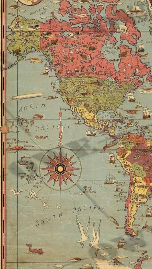
Historic nautical charts were functional documents, but many were also visually impressive. Cartographers often included elaborate compass roses, decorative lettering, sea monsters, ships, coastal settlements, and other artistic elements.
Compass roses were particularly important because they provided directional information. Some charts also used rhumb lines radiating across the sea to assist navigators with plotting courses.
The decorative elements can make historic charts attractive to modern collectors and display enthusiasts. However, they should not overshadow the practical information contained within the documents. Every symbol, line, and notation could have served a navigational or geographical purpose.
Why Historic Nautical Charts Still Matter
Modern navigation depends heavily on digital systems, satellite positioning, electronic charts, and sophisticated surveying technology. Yet historic nautical charts remain important because they preserve the story of how modern geographical knowledge developed.
Researchers can use them to study changing coastlines, historical place names, navigation practices, maritime trade, exploration routes, and surveying techniques. Historians can compare charts from different periods to understand how geographical knowledge expanded.
Collectors appreciate these documents for their rarity, craftsmanship, historical importance, and visual character. Museums and archives preserve many examples because they provide direct evidence of earlier maritime experiences.
Preserving the Stories of Famous Voyages
Historic nautical charts connect modern audiences with voyages that took place centuries ago. A chart showing the route of a famous expedition can make an otherwise distant historical event easier to understand.
The voyage of Columbus represents the expansion of Atlantic exploration. Magellan's expedition demonstrates the enormous scale of global navigation. Cook's surveys reveal the growing precision of scientific exploration. Flinders's charts demonstrate the importance of systematic coastal surveying.
Together, these documents tell a story of gradual discovery. They show that our modern understanding of oceans and continents was not created all at once. It developed through countless observations, journeys, corrections, and discoveries.
Conclusion
Famous voyages preserved in historic nautical charts offer a unique window into the history of exploration. These charts document the routes taken by sailors, the coastlines they observed, and the geographical knowledge they brought back to the wider world.
From early Atlantic crossings to detailed Pacific surveys and the challenging search for northern passages, each voyage contributed something to the evolving picture of the Earth. Historic nautical charts preserve those contributions in a form that can still be studied and appreciated today.
They are therefore much more than old maps. They are records of human ambition, navigation, scientific observation, and discovery. By studying them, we can follow the paths of famous explorers and understand how centuries of maritime journeys helped transform an uncertain world map into the detailed global geography known today.