
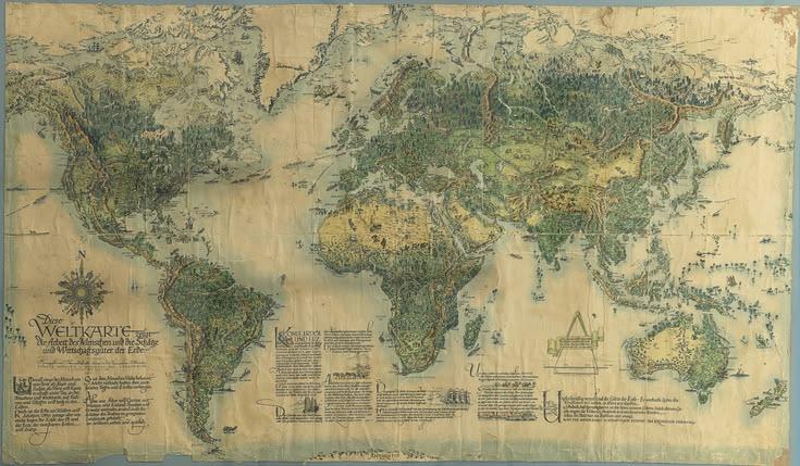
Historical Maps for Collectors: Discovering Stories Through the Maps of the Past

Historical maps for collectors offer far more than attractive illustrations of places that existed generations ago. Each map can provide a fascinating window into the past, showing how cities expanded, borders changed, roads developed, coastlines were recorded, and unfamiliar regions gradually became better understood. For collectors, historical maps combine art, geography, history, exploration, and craftsmanship in a single remarkable object.
A carefully selected historical map can become a meaningful addition to a private collection, study, office, library, or home. Whether someone is interested in old world maps, antique city plans, maritime charts, regional maps, or maps connected with famous journeys, collecting these pieces can become a rewarding long-term interest. Every map has its own character, and many reveal details that are easy to overlook at first glance.
What Makes Historical Maps Special for Collectors?
Historical maps are valuable to collectors because they preserve the geographical knowledge and visual style of a particular period. Modern maps are designed primarily for convenience and accuracy, while older maps often reflect the artistic traditions, printing techniques, exploration records, and geographical understanding of their time.
The appearance of an old map can tell a story before a collector even begins studying its details. Decorative lettering, illustrated borders, engraved coastlines, compass decorations, cartouches, regional illustrations, and carefully drawn geographical features can make a historical map visually impressive.
Collectors also appreciate the fact that maps document change. A city shown on a map from centuries ago may look completely different today. Streets may have disappeared, districts may have expanded, rivers may have changed course, and political boundaries may have been redrawn. This makes historical maps particularly interesting for anyone fascinated by how the world developed.
Understanding the Different Types of Historical Maps
Historical maps come in many forms, allowing collectors to build collections around specific interests. World maps are among the most recognizable examples and can show how different generations understood the shape and extent of the known world.
Regional maps provide another fascinating area of collecting. These maps may focus on provinces, counties, territories, or historical regions. They can reveal old settlements, roads, waterways, estates, and boundaries that may no longer appear on modern maps.
City maps are especially popular because urban landscapes can change dramatically over time. An antique plan of London, Paris, New York, Toronto, Lahore, or another historic city can provide an extraordinary comparison between the past and the present.
Maritime charts are another important category. These maps were created to represent coastlines, harbors, islands, waterways, and navigation routes. Their combination of practical information and decorative design makes them appealing to collectors with an interest in exploration and maritime history.
Travel and exploration maps can also hold considerable appeal. Maps connected with historic expeditions, trade routes, discoveries, or journeys can provide additional historical context and make a collection more focused and personal.
The Historical Story Behind Every Map
One of the most rewarding aspects of collecting historical maps is researching the story behind each piece. A map is not simply a picture of geography. It represents what people knew, believed, recorded, and communicated during a particular period.
Collectors often examine the date, cartographer, publisher, place of publication, geographical area, and printing method. These details can help establish where the map came from and why it was produced.
The names appearing on an old map can also provide clues about political and cultural changes. Places may have different names from those used today, while certain settlements may have disappeared entirely. Old boundaries can show how governments and territories developed over time.
This historical context gives collectors an opportunity to go beyond simply owning an attractive object. Research can transform a map into a piece of historical evidence with a much deeper meaning.
How to Start a Historical Map Collection
Beginning a collection does not require owning dozens of maps immediately. A thoughtful collector can start with one subject, period, region, or style and gradually expand from there.
Some collectors choose maps connected with their family history or a particular location they find meaningful. Others concentrate on a specific historical period or cartographer. Another approach is to collect maps showing the development of one city or region across several generations.
Having a clear collecting theme can make research easier and help prevent random purchases. It also gives a collection a stronger identity. Over time, individual maps can form a visual timeline that demonstrates how geographical knowledge and communities changed.
New collectors should spend time learning how historical maps are described and classified. Understanding terms related to editions, reproduction, condition, scale, publication, and cartographic history can make future purchasing decisions much more informed.
Examining the Age and Authenticity of a Map
Authenticity is an important consideration when collecting historical maps. The popularity of old maps means that modern reproductions are widely available. A reproduction can still be beautiful, but it is different from an original historical example.
Collectors should therefore learn how to distinguish original maps from later reproductions. Paper characteristics, printing methods, typography, coloration, dimensions, publication information, and physical signs of age can all provide useful clues.
The presence of an old appearance alone does not prove that a map is genuinely historical. Some modern reproductions are intentionally designed to look aged. Researching the map's history and comparing it with reliable reference material can help establish whether it is an original, a later edition, or a reproduction.
When purchasing a significant piece, provenance can also be useful. Information about where the map came from, previous ownership, publication history, or documentation associated with it may add confidence to the purchase.
Why Condition Matters in Map Collecting
Condition plays an important role in the appeal and desirability of historical maps. Collectors generally examine the paper, printed details, margins, folds, lettering, illustrations, and overall appearance.
Older maps naturally show signs of their age, and these characteristics are not always negative. A map that has been carefully preserved can display the marks of its history while remaining visually attractive and readable.
However, serious damage can affect both presentation and historical interest. Tears, missing sections, excessive fading, stains, or significant alterations may reduce a map's desirability. Collectors should therefore examine a map carefully before making an important purchase.
Condition should always be considered alongside rarity, historical importance, subject matter, and provenance. A rare map with some age-related imperfections may still be more desirable than a common map in excellent condition.
The Appeal of Antique World Maps
Antique world maps have a special place within the collecting community. They illustrate how earlier generations imagined the world's geography and how geographical knowledge expanded.
Some early world maps contain regions that were poorly understood or represented according to incomplete information. Unknown areas might appear differently from modern representations, while oceans, islands, and coastlines could be shown according to the knowledge available at the time.
This makes historical world maps fascinating documents of discovery. A collector can study the map and consider how geographical understanding changed as explorers, sailors, scholars, and cartographers gathered new information.
Decorative features can make these maps particularly striking. Elaborate title panels, sea creatures, ships, portraits, and artistic borders sometimes appear alongside geographical information, turning the map into both a historical document and a work of visual art.
Historical City Maps as Windows Into Urban Life
City maps can be especially rewarding for collectors because they reveal the structure of communities in earlier periods. Streets, public buildings, parks, markets, railways, waterways, and neighborhoods may all appear on a detailed historical city plan.
A collector interested in urban history can compare an old map with a modern map and discover how dramatically a familiar location has changed. A road that once formed the edge of a city may now sit in the center of a large metropolitan area.
Historical city maps can also reveal the priorities of the period in which they were created. Important government buildings, transportation routes, commercial districts, religious buildings, and public spaces may receive particular attention.
For collectors with a personal connection to a city, these maps can have special emotional value because they connect modern places with their earlier identities.
Building a Collection Around a Theme
A themed collection can be more interesting than simply gathering unrelated maps. A collector might focus on historical maps of one country, a particular city, a period of exploration, or the development of transportation routes.
Another interesting theme is the evolution of a specific region. Collecting maps from different periods allows the collector to create a visual record of geographical and political change.
Some collectors focus on cartographers whose work had an important influence on mapmaking. Others concentrate on particular publishers or printing traditions.
A strong theme can also make it easier to organize and display the collection. Instead of appearing as unrelated historical objects, the maps can work together to tell a larger story.
Caring for Historical Maps
Proper care is essential for preserving historical maps for future generations. Paper is sensitive to its surroundings, so collectors should think carefully about storage and display.
Maps should be kept in a clean, stable environment away from excessive moisture, direct sunlight, and conditions that may cause unnecessary deterioration. Acid-free storage materials are commonly preferred by collectors and archivists because they are designed for long-term preservation.
When displaying a valuable map, framing should be approached thoughtfully. Suitable archival materials can help protect the map while allowing its details to remain visible.
Collectors should also handle historical maps carefully, particularly large folded examples or older pieces that may be delicate. Clean hands and a clean working surface can reduce the risk of accidental damage during examination.
Displaying Historical Maps in a Home or Office
Historical maps can make distinctive decorative features in both traditional and contemporary interiors. A large antique world map can create an impressive focal point in a study, library, office, or living room.
Smaller regional or city maps can also work beautifully as part of a gallery-style display. A carefully selected group of related maps can create a visual narrative while adding historical character to the room.
The best display approach depends on the map itself. Highly detailed maps benefit from positioning where viewers can examine their fine lettering and geographical features. Large decorative maps can work effectively as statement pieces.
Collectors should balance presentation with preservation. A map should be displayed in a way that protects it from unnecessary environmental exposure while allowing its historical details to be appreciated.
Research Makes Collecting More Rewarding
Research is one of the most enjoyable parts of collecting historical maps. Before purchasing a map, collectors can investigate the cartographer, publisher, date, region, edition, historical background, and known examples.
Books about cartography, specialist catalogs, museum collections, libraries, and reputable map dealers can provide valuable information. Comparing similar maps can help collectors understand differences in editions and publication history.
Over time, research knowledge becomes one of the most valuable parts of collecting. A collector who understands the background of maps is better prepared to recognize interesting pieces and make informed decisions.
The Growing Appeal of Historical Maps for Collectors
Interest in historical maps continues because they connect several subjects at once. They appeal to people interested in history, geography, exploration, architecture, genealogy, art, printing, and local heritage.
Unlike many modern digital resources, a physical historical map has a tangible presence. It can be examined closely, displayed, studied, and passed down as part of a family's collection.
For some collectors, the greatest attraction is discovering an unusual map that reveals something unexpected about a familiar place. For others, it is the beauty of traditional cartographic design. For many, it is simply the pleasure of holding a genuine piece of the past.
Finding the Right Historical Maps for Collectors
When searching for historical maps for collectors, patience and research can make the experience much more rewarding. Instead of choosing a map only because it looks attractive, collectors can consider its historical importance, rarity, condition, authenticity, subject, and relevance to their personal interests.
A good collection does not necessarily need to be large. A small group of carefully chosen maps can have tremendous character when each piece contributes something meaningful to the overall theme.
Collectors can gradually develop their knowledge, refine their interests, and discover new areas of cartographic history. Every new acquisition can open the door to another story about a place, a period, or a changing understanding of the world.
Conclusion
Historical maps for collectors are remarkable objects because they preserve far more than geographical information. They capture changing borders, growing cities, exploration, artistic traditions, transportation networks, and the way earlier generations understood their surroundings.
Whether the focus is antique world maps, historic city plans, regional charts, or maps connected with exploration, collecting offers an opportunity to explore the past through authentic visual records. With careful research, thoughtful selection, proper preservation, and a clear collecting theme, historical maps can become a lasting source of knowledge and enjoyment.
For anyone fascinated by the stories hidden within old places and changing landscapes, historical maps provide an extraordinary way to connect with history. Each map has a journey of its own, and together, a carefully developed collection can become a unique visual history of the world.